|
|
 |
|
|
|
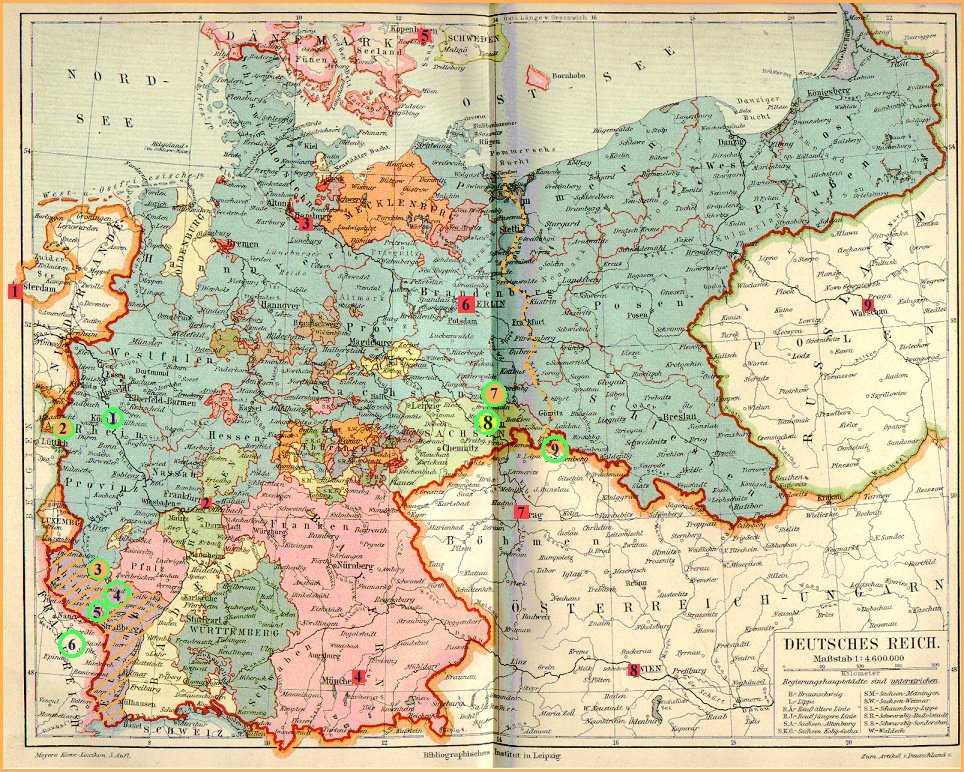
Map of Central Europe 1871 – 1918
|
|
|
|
|
- Hatched area in southwest corner: Alsace-Lorraine,
annexed to Germany, 1871 – 1918 and 1939 –
1945.
- Dotted orange line in center: today's eastern border of Germany.
- Red squares with numbers: major cities or capitals.
- Green circles with numbers: major glassworks or glass regions.
|
|
|
|
|
|
Cities:
|
Glassworks:
|
|
1: Amsterdam
|
1: Ehrenfeld (near Cologne)
|
|
2: Frankfurt/Main
|
2: Stolberg (near Aachen)
|
|
3: Hamburg
|
3: Villeroy & Boch, Fenner Glashütte
|
|
4: Munich
|
4: Meisenthal, St. Louis
|
|
5: Copenhagen
|
5: Dreibrunnen (Troisfontaines), Vallérysthal
|
|
6: Berlin
|
6: Baccarat, Portieux
|
|
7: Prague
|
7: Bernsdorf, VLG, von Streit ("Niederlausitz")
|
|
8: Vienna
|
8: Brockwitz, Malky, SG, Walther ("Oberlausitz")
|
|
9. Warsaw
|
9: [Bohemia]
|
|
|